No products in the cart.

Salesforce Maps & Territory Planning

Optimizing Field Operations

Salesforce Maps is a location intelligence tool that brings geospatial visualization and route optimization into Salesforce data, and Territory Planning is a related capability for defining and balancing sales territories. ACEEN’s consulting in this area helps organizations with significant field operations or geographically dispersed sales teams make the most of these features. Salesforce Maps allows you to plot leads, customers, or assets on a map and create optimized travel routes for field sales or service reps.

Transform Field Operations with Salesforce Maps

Salesforce Maps enables organizations to visualize leads, customers, and assets on an interactive map. Field sales or service representatives can generate optimized travel routes that allow them to maximize the number of customer visits each day while minimizing travel time.

For example, a medical device company can empower its representatives to view all hospitals in their assigned region—both leads and existing customers—then plan their daily visits in the most efficient order. This results in more client interactions, better territory coverage, and significant time savings.

Balanced Territories for Maximum Potential

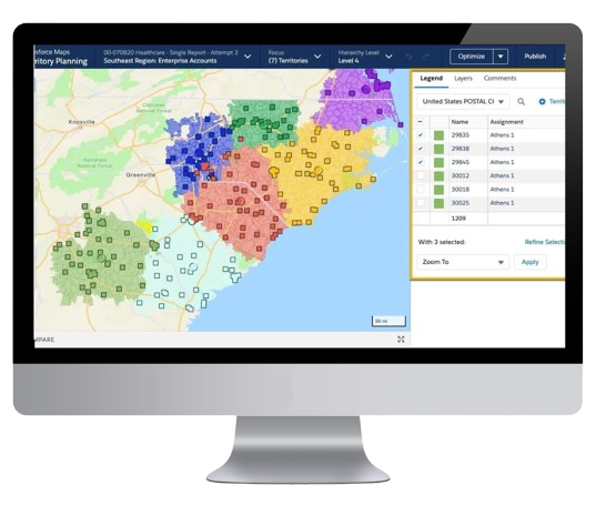
Territory Planning helps organizations design sales or service regions that balance customer volume, market opportunity, and rep workload. Using Salesforce Territory Management and the planning tools available within the Salesforce Maps suite, ACEEN assists companies in assigning leads and accounts using criteria such as geography, industry, and account size.

When a territory becomes overloaded with high-value accounts or another territory receives too few, ACEEN helps adjust boundaries to distribute opportunities more evenly. This improves rep morale, strengthens customer coverage, and ensures every territory is designed for sustainable performance.

Advanced Data Integration for Deeper Insights

ACEEN can also incorporate third-party mapping data—such as demographic layers, market size indicators, or competitive information—to enhance territory insights and support smarter decision-making. These external data overlays give leaders a more accurate view of where opportunity exists and where adjustments may be needed.